|
|

Saturday, June 18, 2011
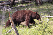
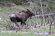
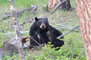
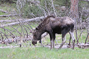
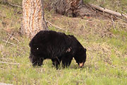
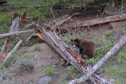
It's 38 when we leave the cabin on our last day. Rushing under the old wooden bridge, Soda Butte Creek does not seem as swollen this morning At the east entrance, a moose trots into the trees, barely visible except for its white socks. Farther down the road close to Round Prairie another moose grazes close to the road. The young bull's antlers are coming back and are small right now, the one feature that easily distinguishes him from the cow at the east entrance. A cinnamon colored black bear walks up the slope near the entrance to Pebble Creek campground.
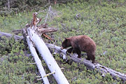
 He steps over fallen trees and rips a log strip of wood from a log, looking for insects.
A crowd is gathered at Hitching Post waiting for the Lamar Canyon Pack. Spotting scopes are pointed in different directions and it looks like nothing is going on. We continue through the valley to Lamar Canyon to Slough Creek to Petrified Tree and to Hellroaring. We look for the carcass a ranger told us about at Petrified Tree and still can't find it among the trees and grass. We must have gotten it wrong.
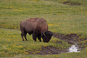
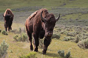
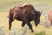
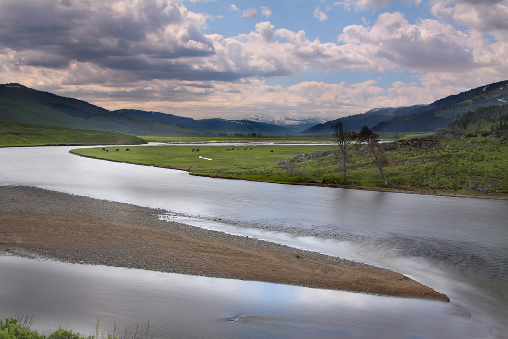
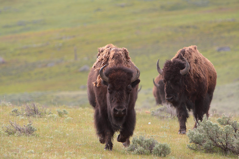
The sand hill crane has tucked her head under her wing. Still haven't seen the male yet, or the new chick(s). The pond is very quiet. I don't see the little goslings either. We turn around and make a quick run to Dunraven where we scan the valley and Mt. Washburn. Elk lie bedded in the meadows and bison graze quietly.
It's warming up with a clear blue sky. This is Tim's chance to photograph Tower Falls from the bottom. We gather camera equipment and jackets and head for the overlook when we see a small sign that says the bottom of the trail is closed due to poor conditions, so we go back to Hitching Post.
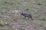
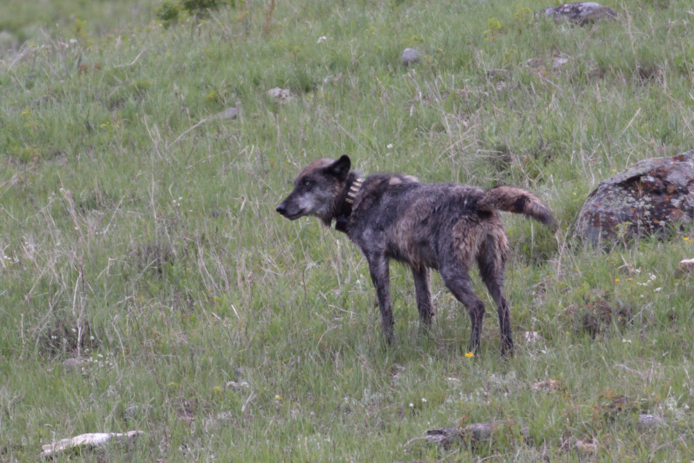
Just as we reach the Confluence, we see him running in the grass.
754 is retuning to the den. He is rangy looking, shedding his black fur. He trots through the Confluence, sniffs around its banks and then crosses the road. He follows the same path made by 21M. There is a no-stopping zone on the road where it curves around the point where Soda Butte Creek meets the Lamar River. We cannot stop so we inch along the pavement as 754 steps up to the road and crosses. After he climbs the hill toward the den we pull into Hitching Post.
 The wolf party is basically over now. 755 is still in the area - they are getting his signals - but there is no sign of him yet.
We are running out of time. Wanting to make every moment count we reverse once more and head toward Lamar Canyon and stop at Fisherman's. The osprey of Lamar Canyon is sitting in her nest. She calls and calls to her mate, but he does not appear. I glance away and suddenly she is standing up and rearranging the nest. Or is it actually the male I see, overpowering the other residents of the nest?
It's getting later, so we turn around once more. The moose and calf from yesterday are gone and a crowd is still waiting for 755M to show up. They stand on the brown and green hills surrounding Hitching Post, spotting scopes pointed toward the Confluence and the trail to the Druids' den site. In my mind I see 21M now, a very large wolf, gray with age, crossing the road and trotting up the steep slope.
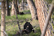
We pass Pebble Creek and Trout Lake. A black bear ambles through Soda Butte picnic area, delighting a crowd jammed into the parking lot. This is one of my favorite areas, the creek, winding past wooden tables through a grassy meadow. It's peaceful and soothing. You can hear the water as it dances past you. Not today with this noisy bunch.
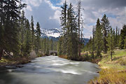
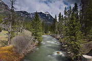
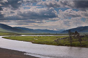
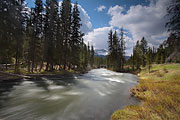
We are almost at Warm Creek, pulling over where Soda Butte Creek crosses under the road. I walk across the road and down into the open meadow edged by forest. Walking toward the trees, you can peek through branches to a clearing on the other side of the creek.
 The ground is soft, marshy in places. I imagine bears coming here in the morning and evening to feed in the tall grasses.
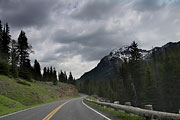
Beartooth Highway is closed. We are stunned. Better switch to Plan B quick which is Chief Joseph to Belfry to Laurel to Billings. The Chief Joseph Highway winds up and down through the mountains along the Shoshone River. It crosses the Clark Fork of the Yellowstone River and passes through red rock canyons, reaching the "T" in the road where you can go right to Cody or left to Billings.
Rt. 172 divides Two Dot Ranch, black cattle on either side, and miles and miles of fence. The landscape here is as different from Shoshone National Forest as it is beautiful. The small towns and farms are green from spring rain. As we near Billings, there are fewer farms along the highway. Tim points out an eagle's nest on top of a telephone pole. Exiting the highway the road to the airport climbs above Billings. We park in a shady spot overlooking the city to sort out last-minute packing and enjoy the view. We jammed a lot into one week - though we missed seeing the wildflowers on the Beartooth. There's always something to look forward to next time.
Author - Christine Baleshta
Photography - Tim Springer

Wallpaper from this trip here
|
Click for larger image
|
|